
Design of a coastal protection scheme for Ada (Ghana)
The government of Ghana wants to protect a stretch of 15 km of coastline in the Ada area, about 100 km east of the capital Accra. Ongoing erosion and regular overtopping leads to the loss of property and reduction of the tourism potential of this area. IMDC was responsible for the design of the coastal protection and the supervision of the construction works.
Project area
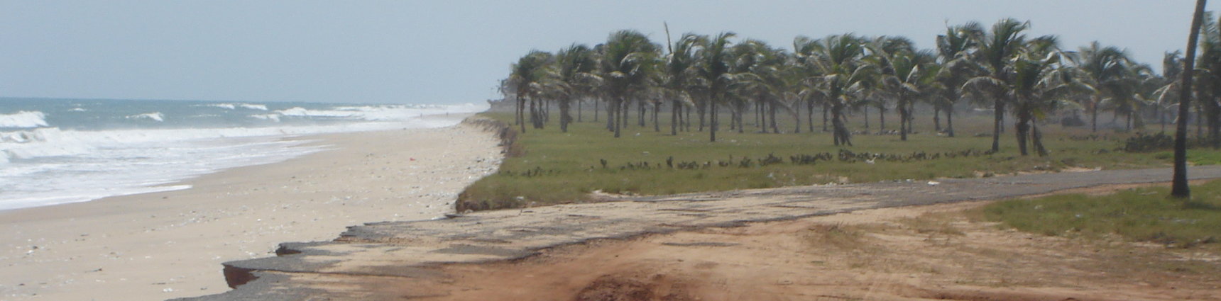
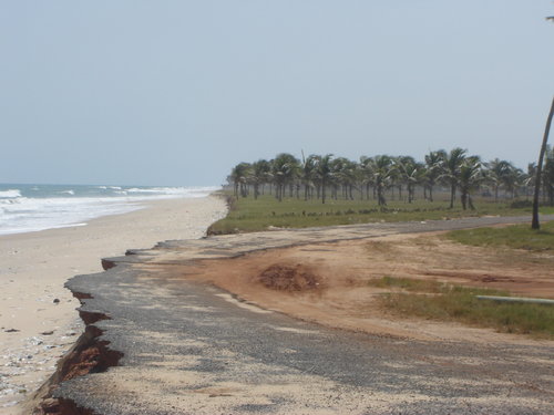
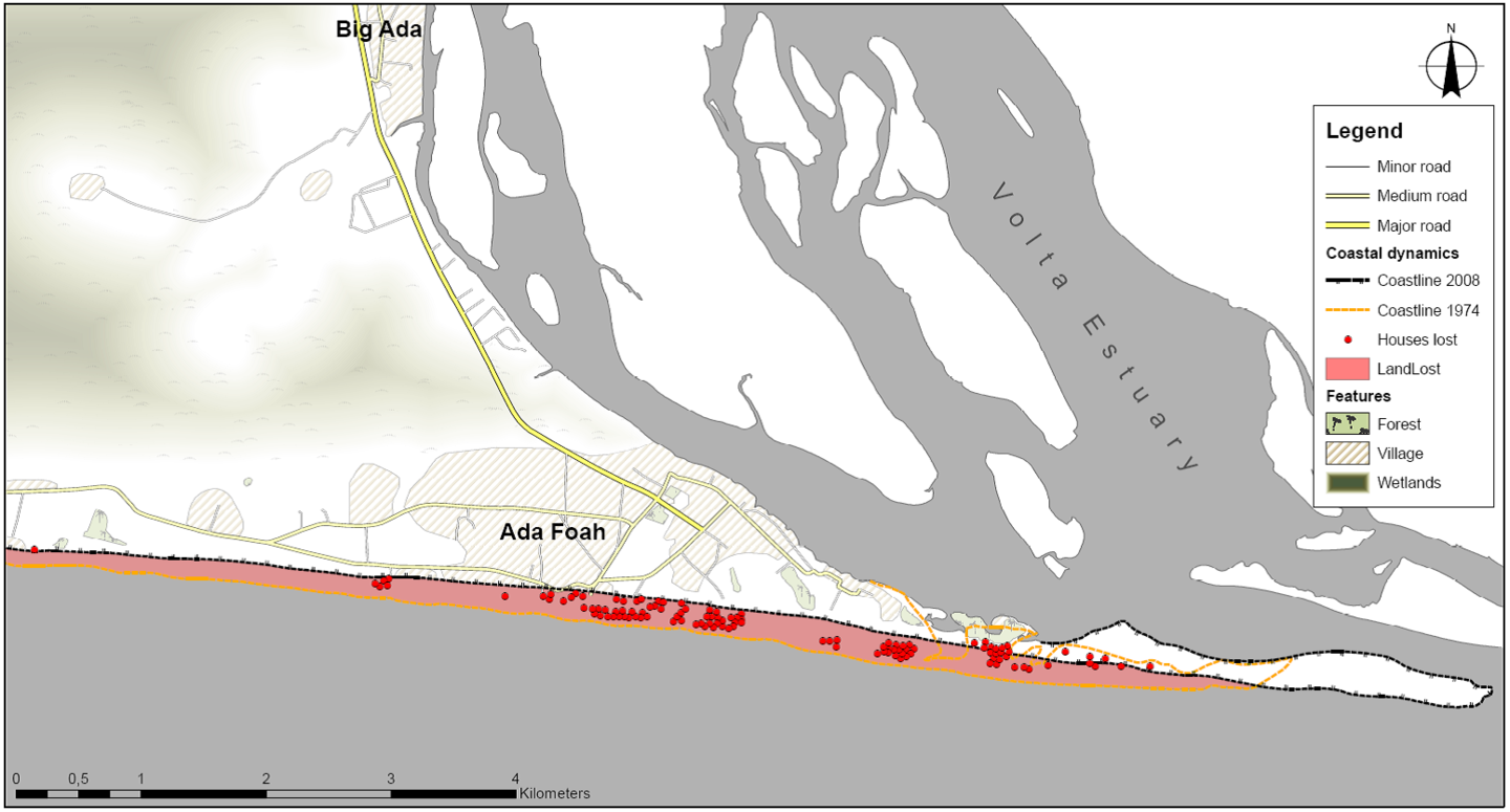
The Ada Sea Defence project consists in the coastal protection of a stretch of 15 km of coastline located on the western side of the Volta River mouth. The closest city is Ada, about 100 km east of the capital Accra.
Ada Foah and the surrounding villages are prone to flooding as a result of the low laying areas and in case of overtopping and flooding the result could be life threatening to the local residents in these areas. The shortfall in revenue from the tourism, fishing and salt mining activities is a direct result of the on-going erosion in the Ada area.
Objectives
The main aim of the project is to protect and stabilise the coastline thus saving lives, property, infrastructure and future development thereby also boosting the economic potential especially in the salt mining, fishing, tourism and energy industries. A combination of groynes and beach nourishment were designed to protect the coastline.
Studies and design
For the design a number of specialised studies and investigations are undertaken to determine the physical conditions for the design and construction of the groynes and the beach nourishment.
A measurement campaign has been set up to determine the bathymetry, the topography, the actual morphology, the geotechnical conditions and the hydraulic conditions (such as water levels, winds, currents and waves).
Numerical modelling of waves, hydrodynamics and sediment transport allowed us to select and optimise the design and the lay-out of the groynes and the beach nourishment. Whereas the hydrodynamic and wave modelling allowed us to determine the expected loading on the beach and the groynes, the morphological modelling gave insight in the local sediment transport phenomena and allowed us to test different scenarios with respect to their effectiveness and impact on the coast.
The stability of the groynes was tested in a physical model before construction. After the design was finished, the technical specifications and construction guidelines for the contractor were written.
Supervision
IMDC organised the on-site supervision of the construction works to verify that works were performed according to the technical specifications.
Data
- Client: Government of Ghana, Ministry of Water Resources, Works and Housing
- Start date: 2009
- Completion date: 2016
related references
-

-
Coasts & EstuariesCoasts & Estuaries
-
-

-
Coasts & EstuariesCoasts & Estuaries
-
-

-
Marine, Dredging & Port EngineeringMarine, Dredging & Port Engineering
-
Coasts & EstuariesCoasts & Estuaries
-
InnovationInnovation
-
Hydro-Environmental ServicesHydro-Environmental Services
-
-

-
Coasts & EstuariesCoasts & Estuaries
-
Hydro-Environmental ServicesHydro-Environmental Services
-